
Making Exeter cooler
Image credit: Forsaken Films via Unsplash
We want to make Exeter cooler! Not just in the super cool science centre we want to create, but through working with local communities to make their spaces more climate resilient, via nature-based solutions (including planting trees and the clever use of plants).
Trees and plants don’t just provide cooling by shading – they cool the local area through transpiration, and can provide lots of added benefits too, such as increasing biodiversity, reducing flood risk, capturing pollution and reducing noise.
What we’re doing
We have installed one of these nature-based solutions on our office building in Marsh Barton: a living wall!
Apart from the many benefits of living walls, such as improving insulation, helping biodiversity and storing carbon, our living wall is part of a research project with the University of Plymouth. As well as this research project, we have launched our own citizen-science project to measure the biodiversity on our site which you can get involved with too!


Project background
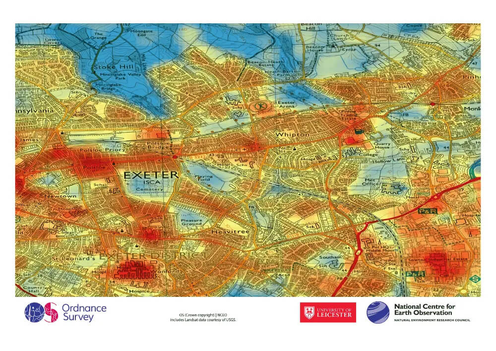
Did you spot the land surface temperature ‘heat map’ of Exeter in our climate exhibition (below)? It’s also featuring in our current major project Our World From Space, where we exploring how these images are made using infrared imaging – and how we can use these images to guide how we can adapt to the effects of climate change (extreme heat, flooding, as well as biodiversity loss).
We can make a difference in our own outdoor spaces to tackle this!
We’d like to explore how this kind of satellite data can inform why – and where – communities should plant trees and other vegetation in their local area, and work with them to make a really awesome, science-informed project on it, bringing in the help of local researchers and other relevant experts, but with communities at the helm.
Get involved
We’re currently seeking funding to grow the Making Exeter Cooler project with target communities in Exeter.
If you’re part of an Exeter community that might be interested in this, get in touch! We’re trying to make sure our limited resources make as great a difference as possible, so we’re focusing on communities who meet our criteria for disadvantage. However, if your community is already doing great things in this area (and can offer advice or inspiration), or you’re part of a community who might like to get involved in future, we’d love to hear from you.
If you love what we do and want to support this project or our work more broadly, here’s how you can support us!